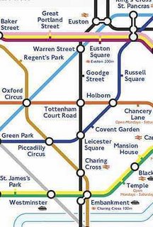
 April 9, 2006 - Check out these two google maps showing the New York subway system and the London Tube combined with the city's streets. I like the London one better since you can actually zoom in/out and move around. Notice how both systems don't exactly follow any particular street - unlike Toronto's - they just seem to go criss-cross throughout the two cities. Another thing I noticed was how far the London Tube actually travels. Some of the lines (Central, District, Metropolitan) go way into the suburbs and truly define the Tube as a regional system.
London Tube Google Map: http://tubejp.co.uk/
New York Subway Google Map: http://www.onnyturf.com/subwaymap.php

No comments:
Post a Comment